PEORIA, Ill. — Illinois’ new legislative maps are out. And, for the first time, the maps have been drawn up by state politicians without the use of data from the U.S. Census.
Republican State Rep. Ryan Spain, of Peoria, told WMBD’s “The Greg and Dan Show”, there are a lot of problems with the maps.
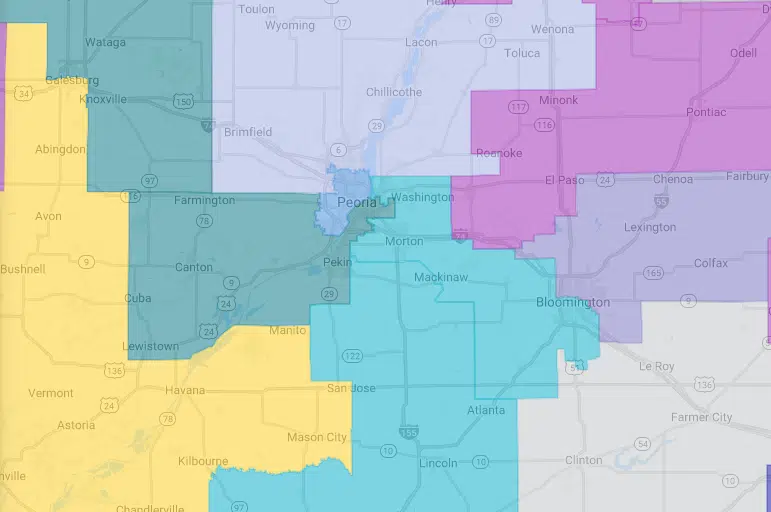
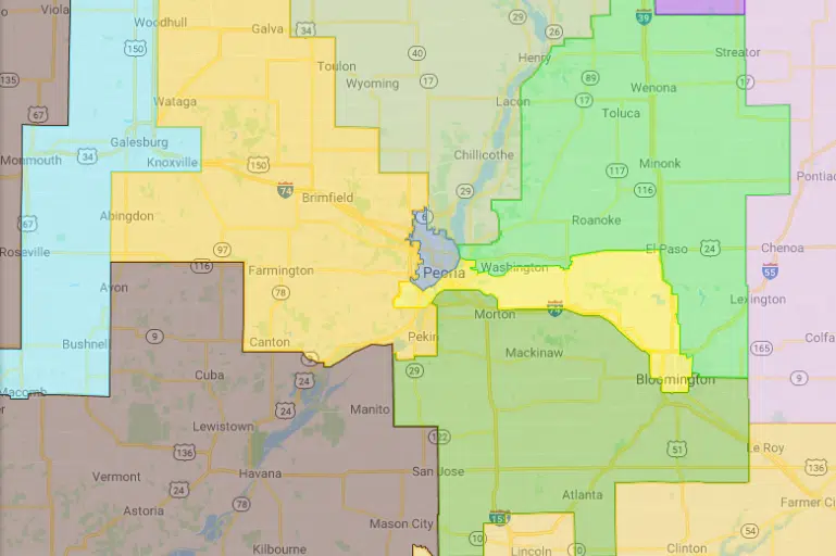
“It looks like it was drawn to divide communities like Peoria, which is really contradictory to all of the testimony we’ve received from witnesses over the past two months,” Spain said.
Public hearings statewide have shown that citizens want to change the way redistricting is done in Illinois, but the maps continue to be drawn up to benefit the Democratic party, Spain said.
Legislators in the General Assembly have been told that some of the data used to reconfigure state maps comes from what’s called the American Communities Survey.
The survey is an estimate of about 1-2% of the population every year, creating a sort of rolling average.
“There’s only one reason to do this, it’s just for a political partisan power grab. We had people stand up and say we weren’t going to do this anymore,” Spain said.
No one’s ever used the American Communities Survey to draw a legislative map before.
Unlike the state legislative maps, Illinois’ Congressional maps will not be drawn up until August, when the latest U.S. Census data will be completed.
Illinois’ General Assembly’s spring session ends Monday, Memorial Day.
Attached are Illinois’ legislative maps from 2011 and the proposed maps for 2021:

Illinois House 2011 District Map

Illinois House proposed 2021 District Map


